A Dispatch from America’s First Petroleum Sacrifice Zone
Inside the National Petroleum Reserve – Alaska, where Indigenous sovereignty, fossil fuel ambition, and climate collapse converge on America’s largest public lands.
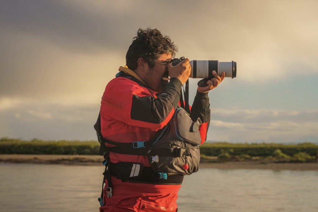
Photos by Paul Wilson
Author’s Note:
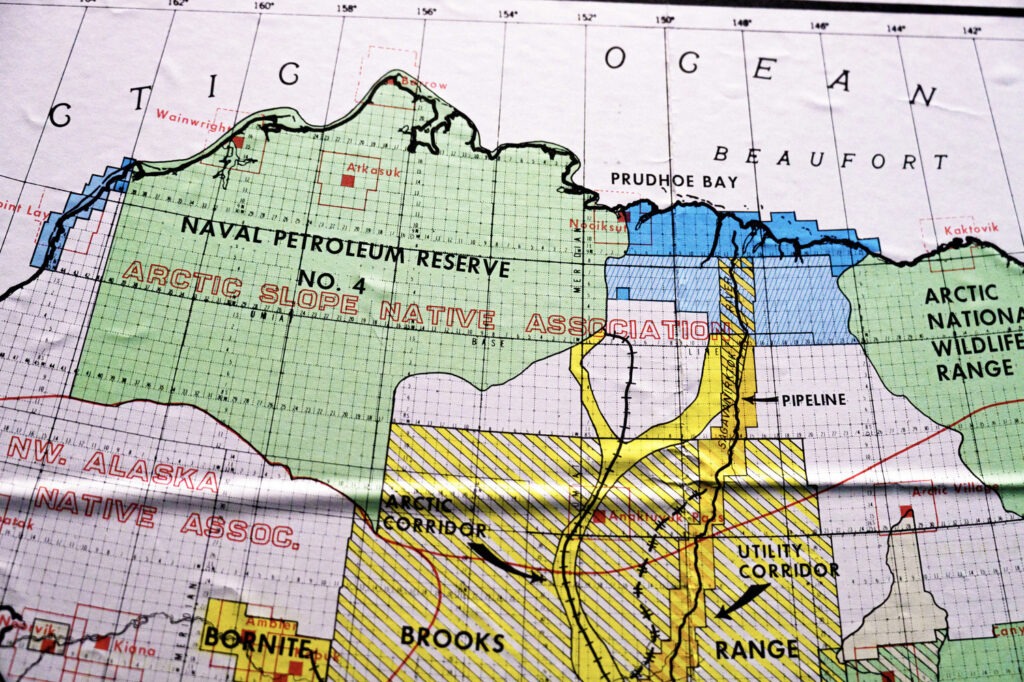
The National Petroleum Reserve–Alaska (NPR-A) is the largest single unit of public land in the United States, spanning nearly 23 million acres across Alaska’s North Slope. Originally established in 1923 as an emergency oil reserve for the U.S. Navy, it has been shaped over the past century by a policy framework that prioritizes extraction over preservation. Although ecologically and culturally similar to the nearby Arctic National Wildlife Refuge, the NPR-A has received far less public attention or protection.
In 2023, the Biden administration approved the Willow Project, a massive oil development in the heart of the NPR-A. But the project’s origins stretch back decades: the underlying leases were first sold in 1999 and 2008 during the Clinton and Bush administrations. By the time Biden took office, ConocoPhillips held valid drilling rights and had already advanced permitting under prior approvals. The decision to greenlight Willow became a legally fraught one. Administration officials weighed climate and environmental concerns against the high likelihood that blocking the project would result in lawsuits. These were lawsuits the federal government was expected to lose, given ConocoPhillips’ legal standing and long-held leases. The result was a compromise that attempted to reduce the project’s scope while still allowing it to proceed, sparking frustration from both environmental advocates and Alaska Native communities opposed to the project.
This piece reflects on a 2024 packrafting journey I took through the NPR-A, tracing an ancient Indigenous trade route while grappling with the layered, often contradictory forces shaping this region’s future from climate change, Indigenous sovereignty, and the enduring legacy of energy policy decisions made long before most Americans knew this place existed.
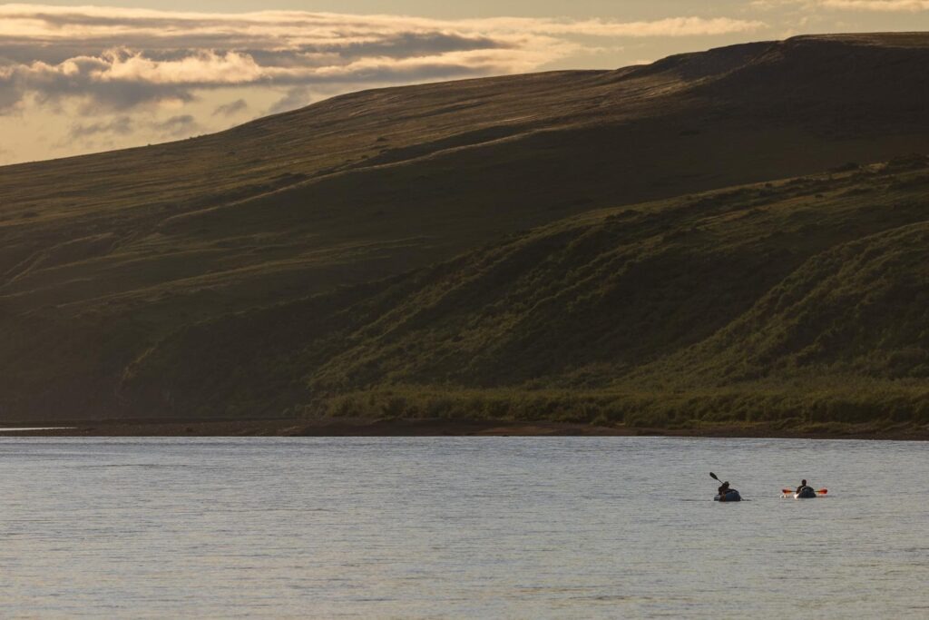
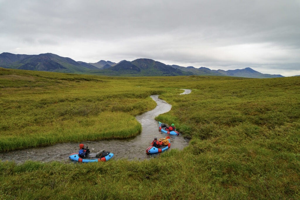
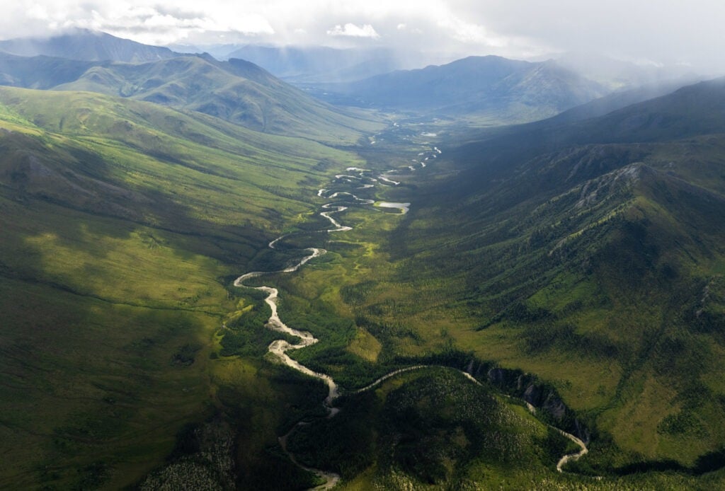
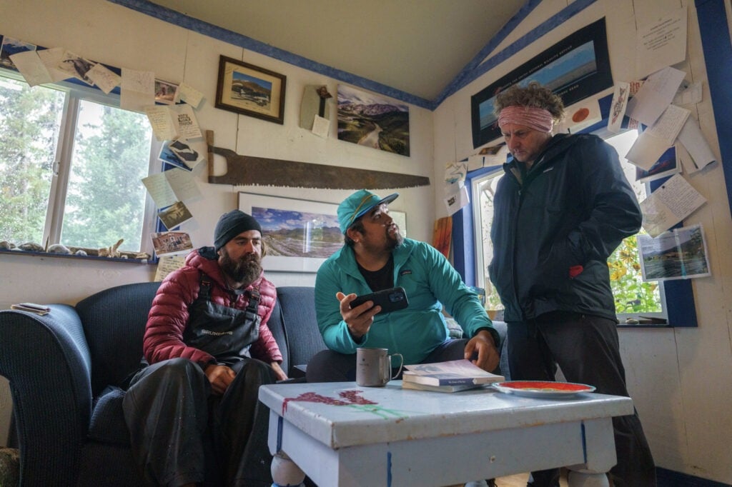
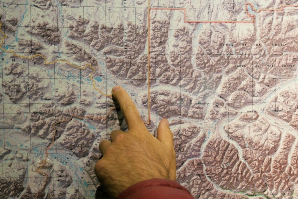
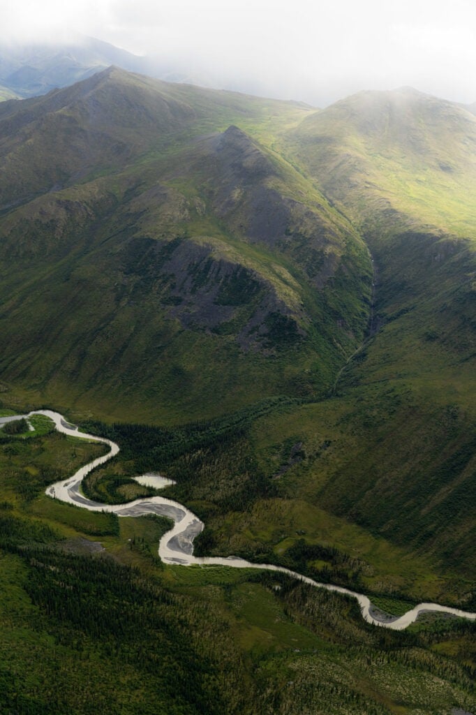
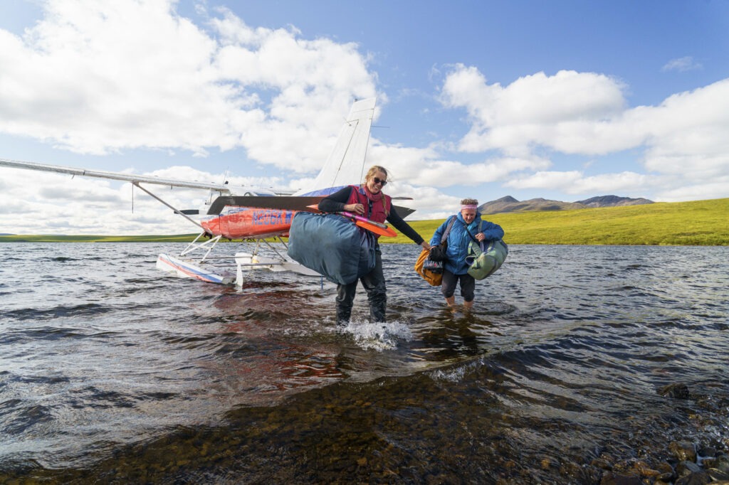
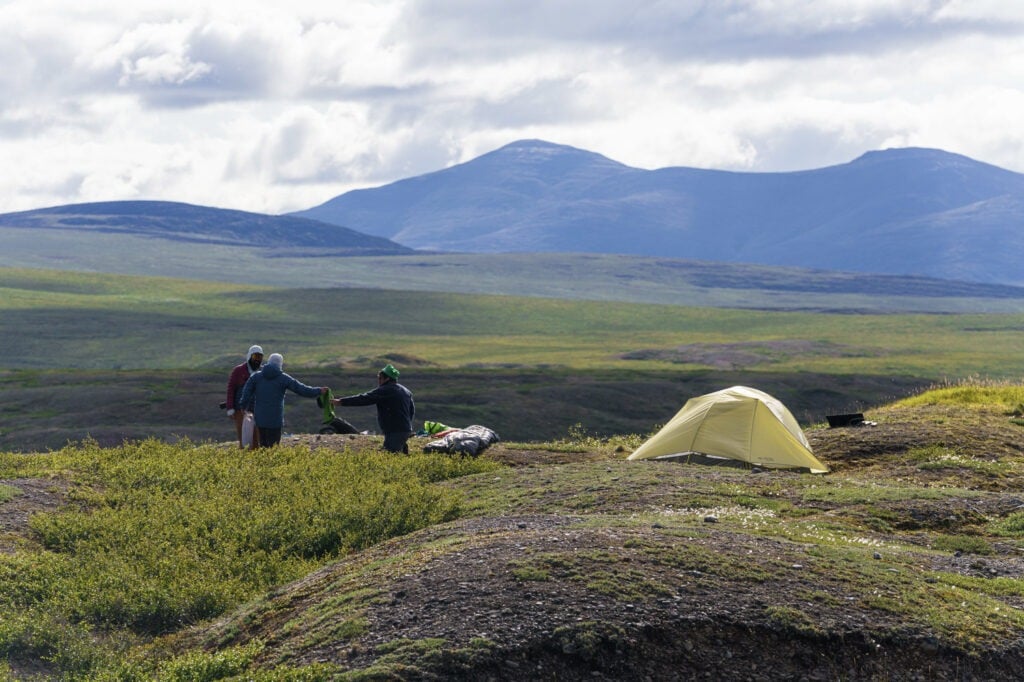
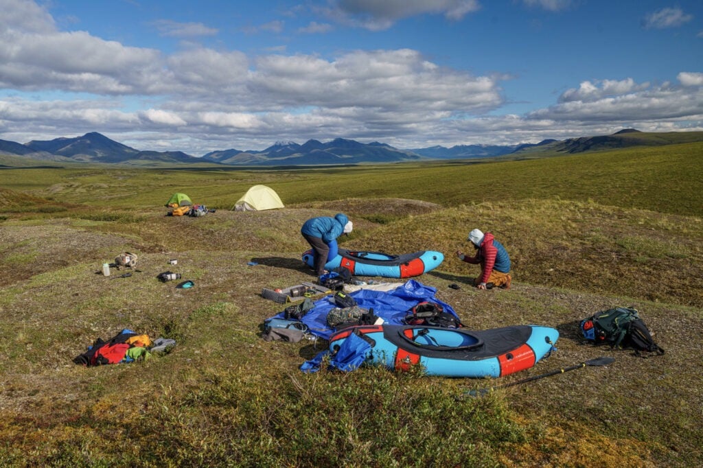
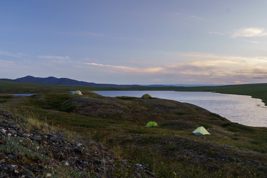
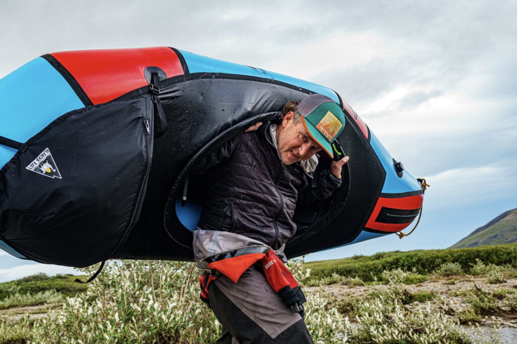
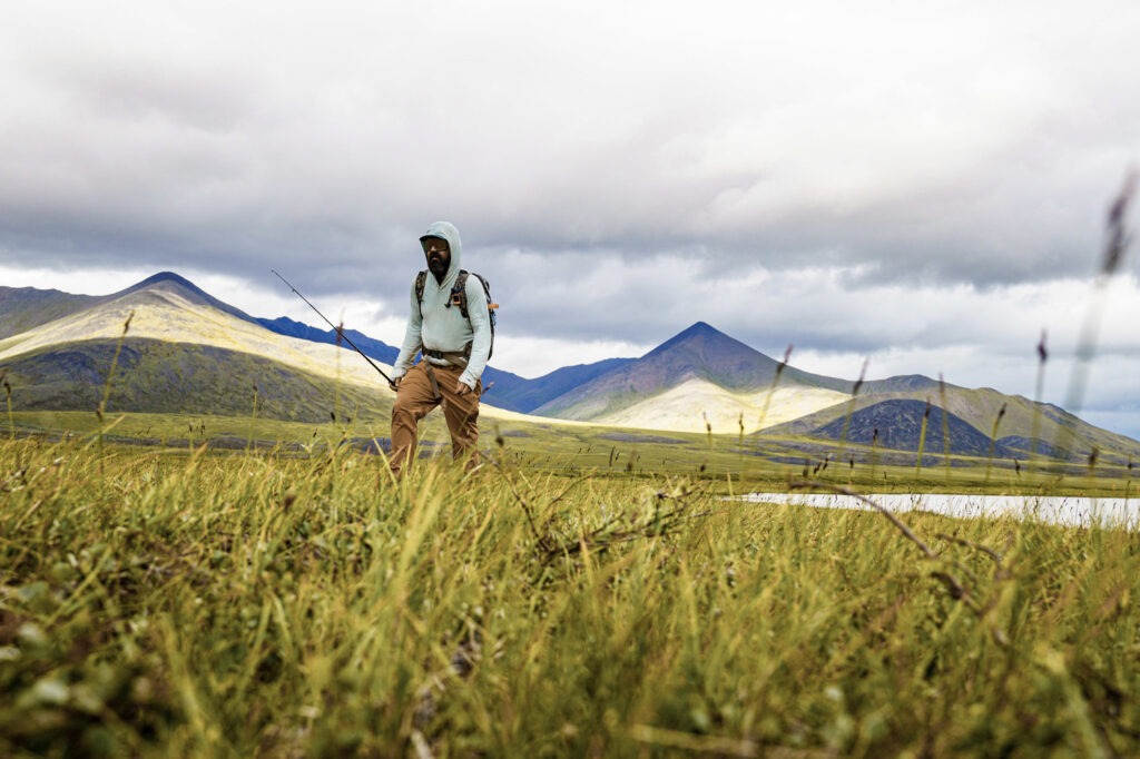
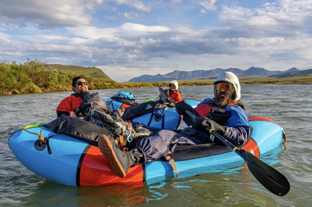
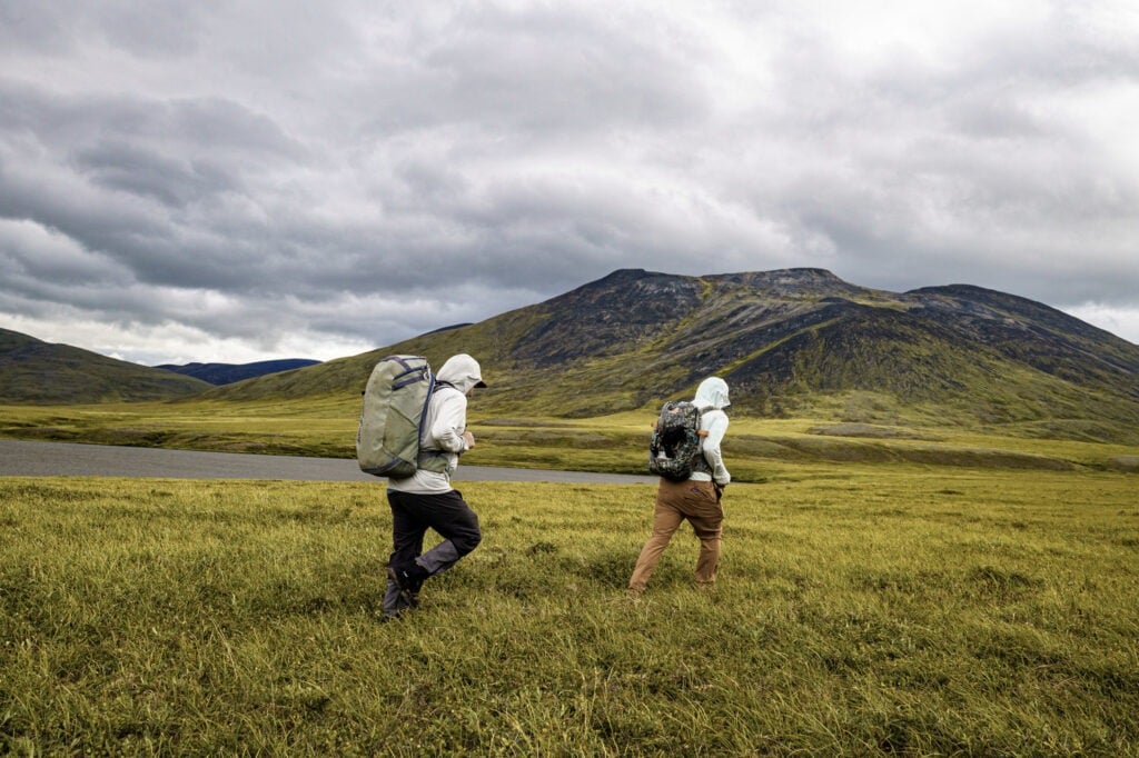
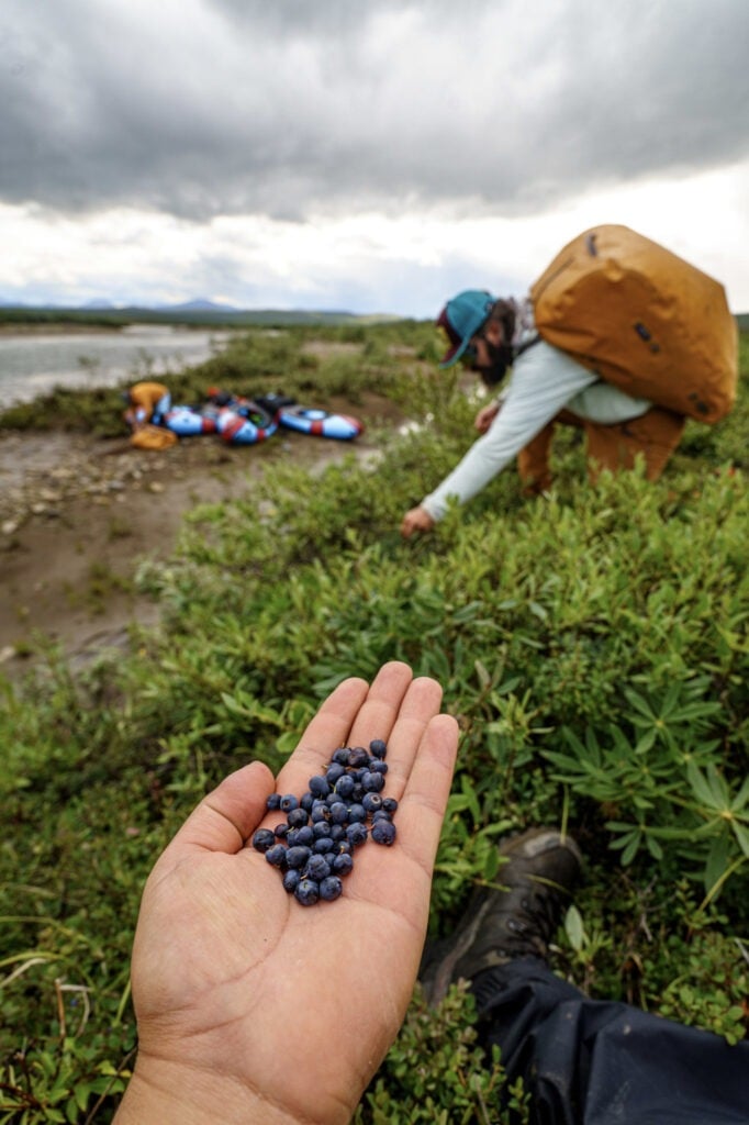
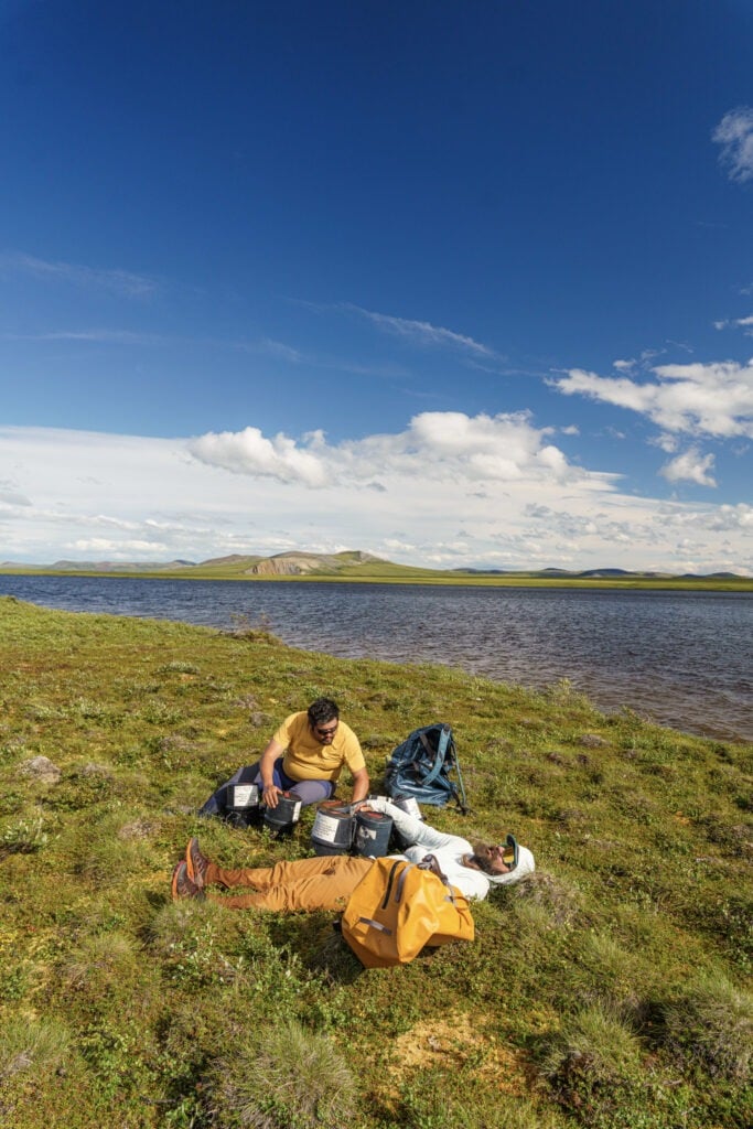
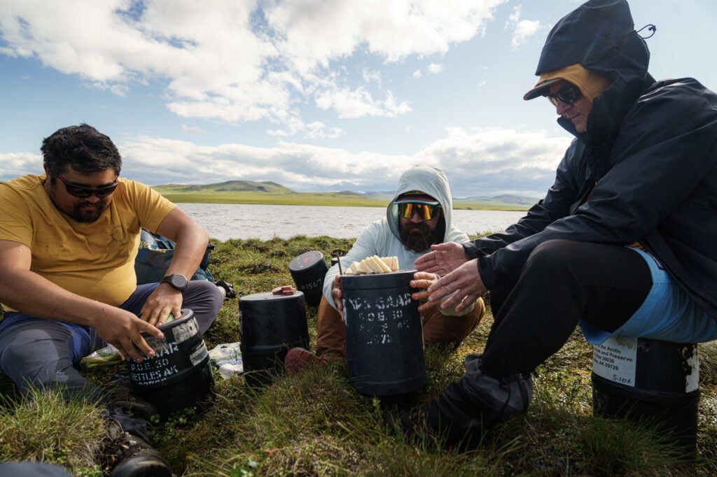
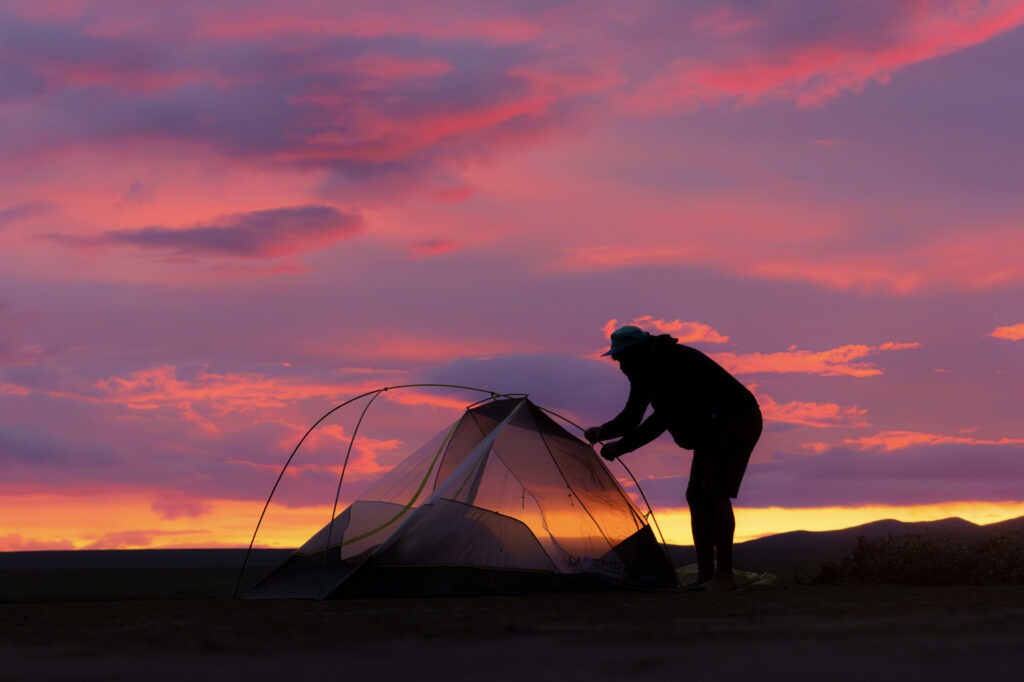
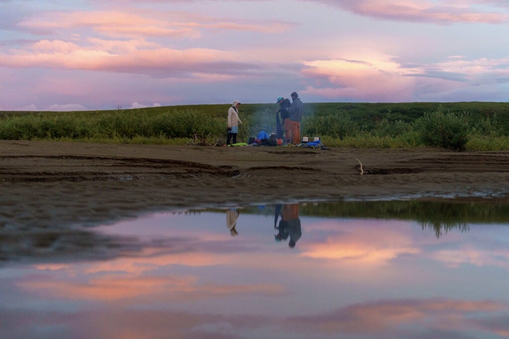
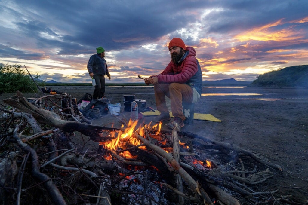
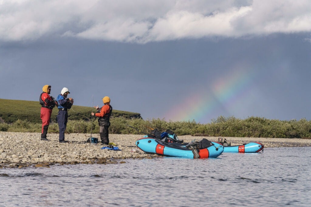
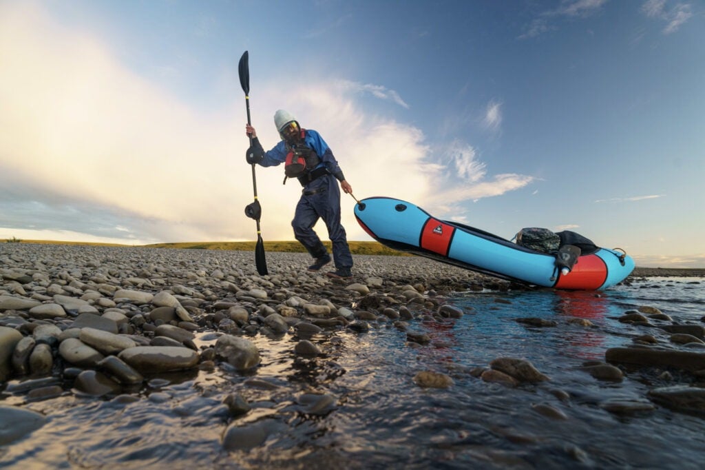
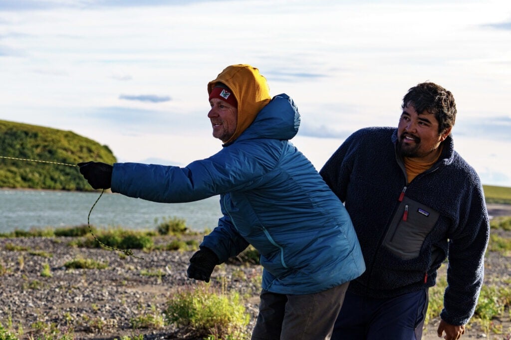
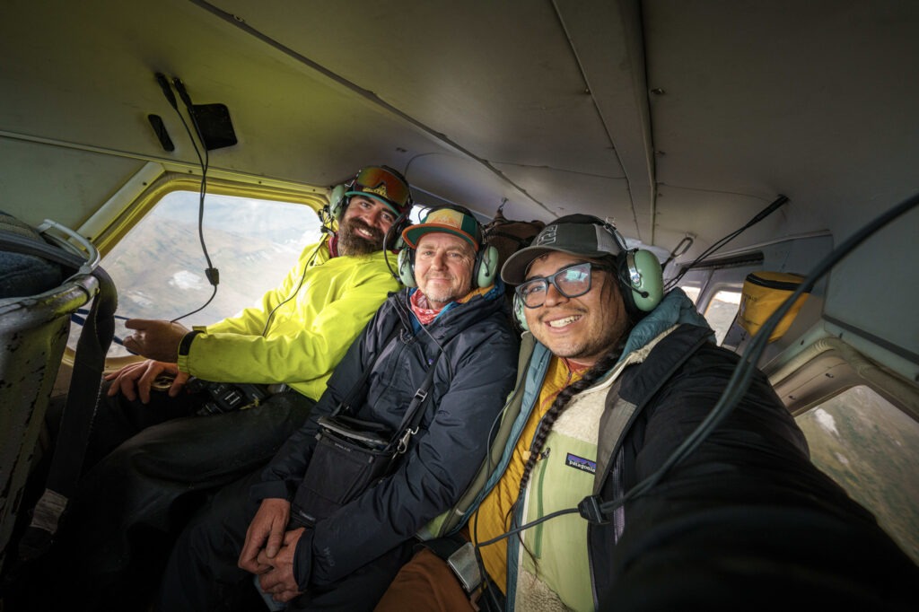
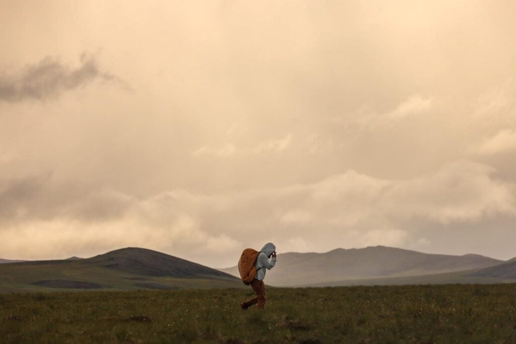
Rivers in the Arctic don’t rush. Many north of the Brooks Range in Alaska wind slowly through the tundra, shaped more by geologic memory than gravity, tracing paths that have outlasted ice sheets, trade routes, and every human attempt to fix them to a map. In August 2024, I led a small team on a 140-mile packrafting expedition through the National Petroleum Reserve–Alaska (NPR-A), following an ancient trade route that connected the Pacific to the Arctic. We weren’t there to conquer anything. We were there to bear witness, to paddle through a region on the brink of change, a place that has been marked, quite literally, for extraction.
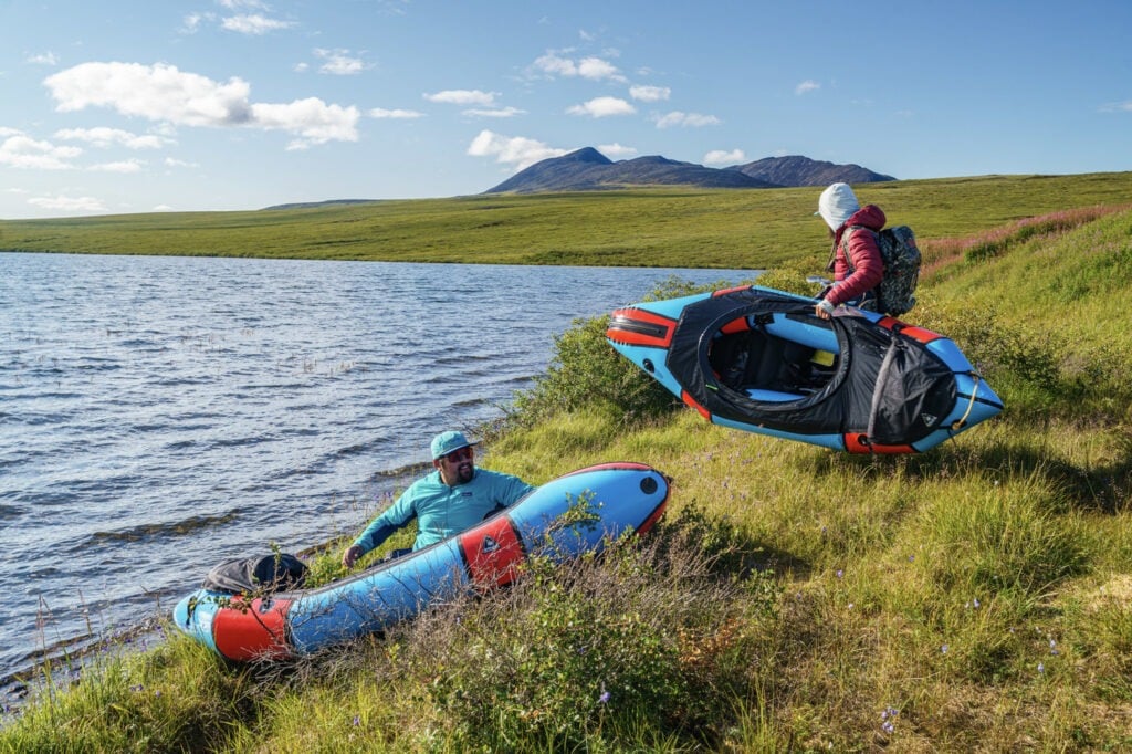
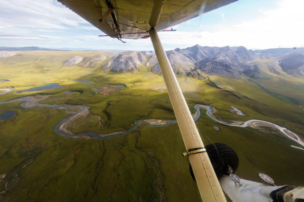
Itivluk Lake lay still when our floatplane departed, its surface glassed over in the low-slung light of Arctic August. The lake sits just atop the continental divide, where waters begin their journey either to the Arctic Ocean or the Pacific. It’s a geographic and cultural hinge point. Scattered across the gentle rise above the shoreline were the remnants of an old village: shallow depressions where sod igloos once stood, half-swallowed by time and grass. We spent the better part of a morning portaging our loaded packrafts from this lake to the river. We towed our crafts behind us through a tundra that looked flat from a distance but gave way to endless ankle-twisting tussocks. Each step was a guess. The earth beneath us alternated between forgiving sponge and ancient trap, eager to claim ankles or knees with each misstep. Above us, mosquitoes sang the ancient song of suffering, circling our heads in an indifferent, carnivorous choir.
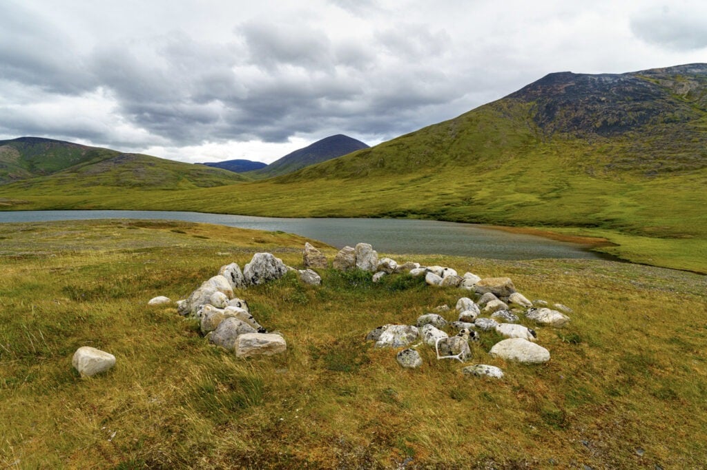
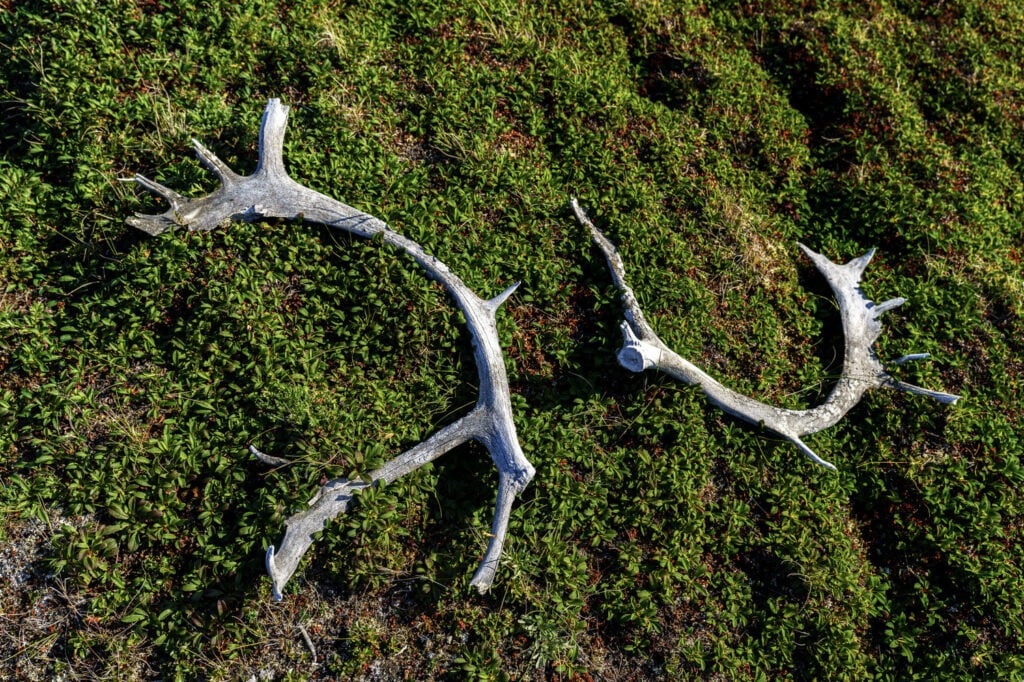
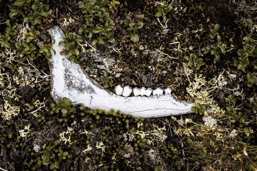
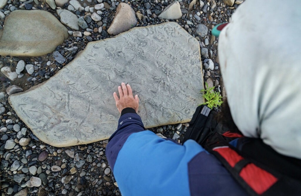
About ten miles downstream, we arrived at a second lake. It was here that we found the remnants of a Pleistocene-era hunting blind. Limestone rocks, stacked chest-high in rough humanoid forms, lined a narrow corridor that pointed inland toward the edges of the lakeshore. These were decoys placed by hunters to guide caribou along a desired path, where others would lie in wait. The intelligence of the design was evident, even millennia later. Nothing here was accidental. This landscape had been studied, lived with, and shaped through generations of close attention. The word “wilderness” doesn’t quite fit. This was a place thick with memory and use, where human and animal histories were long entangled. The Arctic has always been a homeland. It has never been untouched.
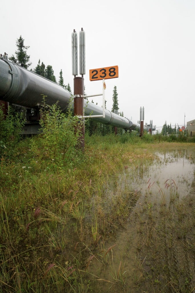
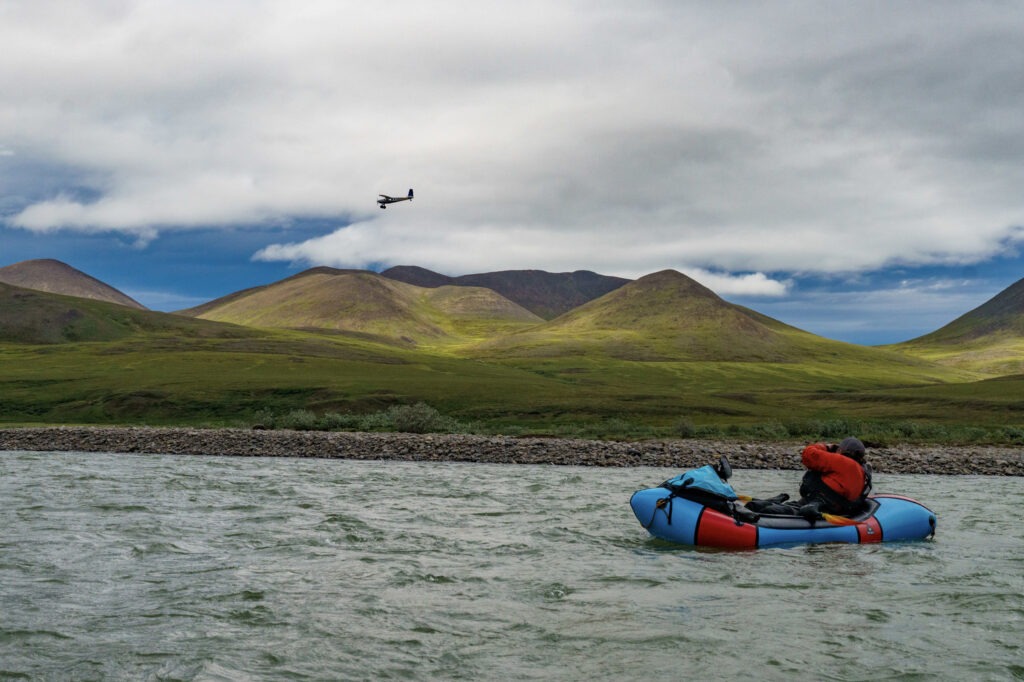
We traveled in the shadow of the Willow Project, a recently approved oil development poised to extract up to 600 million barrels of crude over three decades. Its footprint will expand within the NPR-A, the largest single unit of public land in the United States. The area’s name alone, National Petroleum Reserve, precludes any ambiguity as to its purpose. Unlike the Arctic National Wildlife Refuge to the east, which has become a shorthand for environmental preservation for decades, the NPR-A was created in 1923 explicitly as an oil reserve for the U.S. Navy as it transitioned its fleet from coal to petroleum. It was established before most of the region had been mapped, much less understood. From the outset, the land was framed not as a refuge or homeland, but as a strategic resource for national security. That framing matters. It continues to dictate who sees value in the land, and what kind of future is imagined for it.
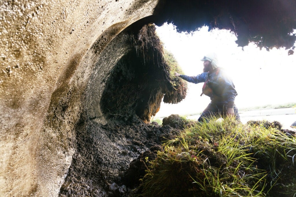
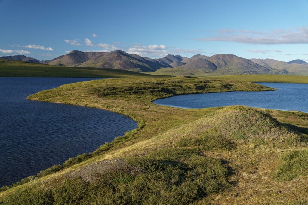
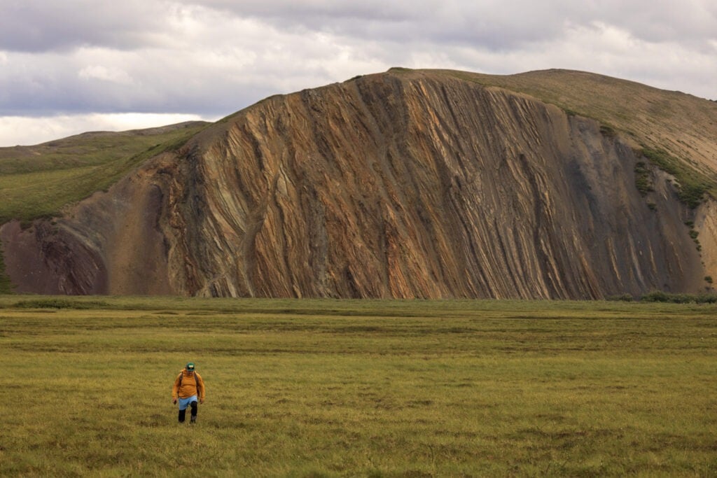
As we drifted farther into the reserve, the river began cutting hard into the tundra. In places, it sawed directly into thawing permafrost banks, thick with ice and lichen. When the permafrost failed, whole slabs of tundra collapsed into the river, their grassy tops still intact, their undersides black and dripping. Some floated downstream like moss-covered barges; others wedged themselves into rock gardens and created temporary rapids, some large enough to flip a packraft. The water surged around them with unexpected force. It was here, in these bends, that the scale of Arctic change became unignorable. This land, once held together by permafrost, is unraveling. Layer by layer. Season by season.
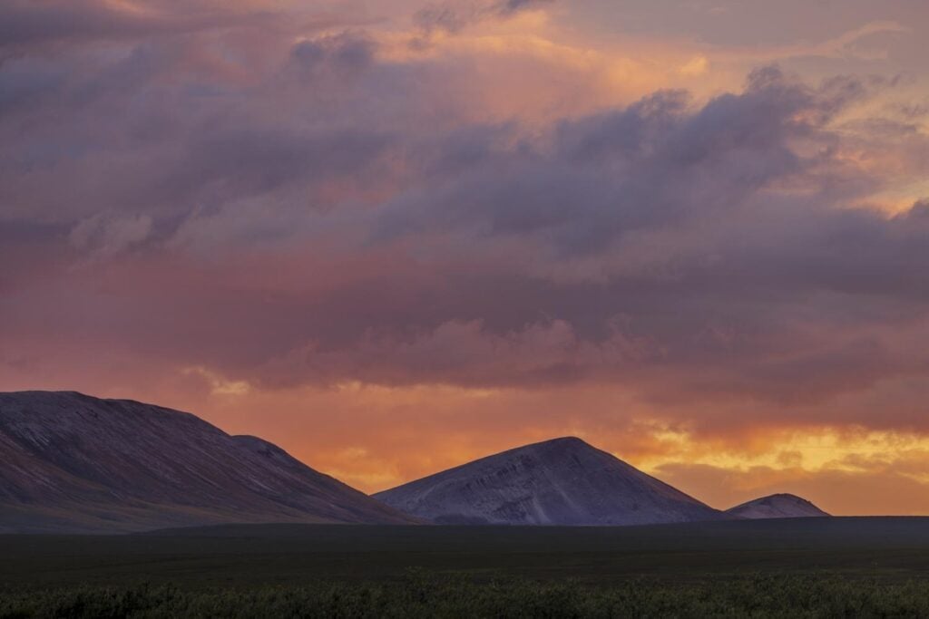
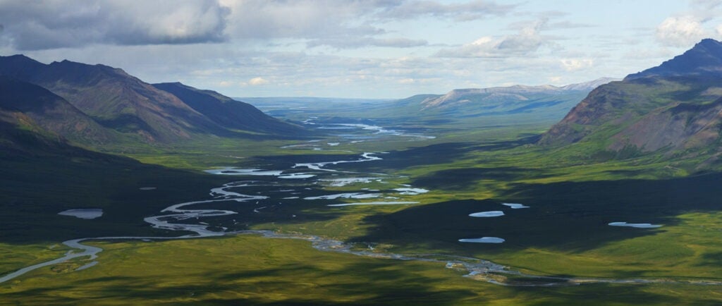
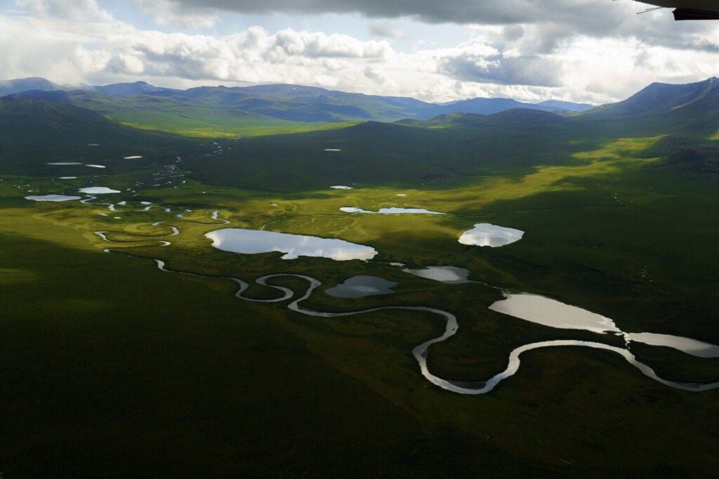
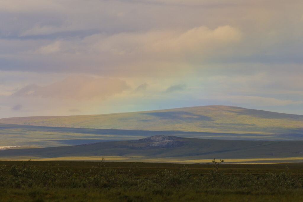
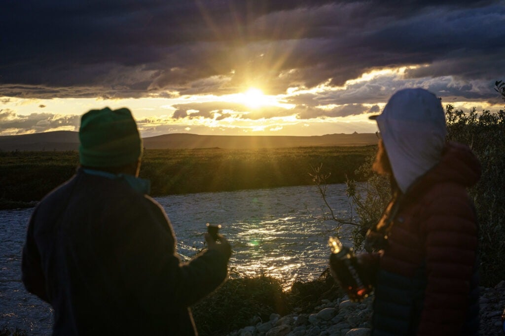
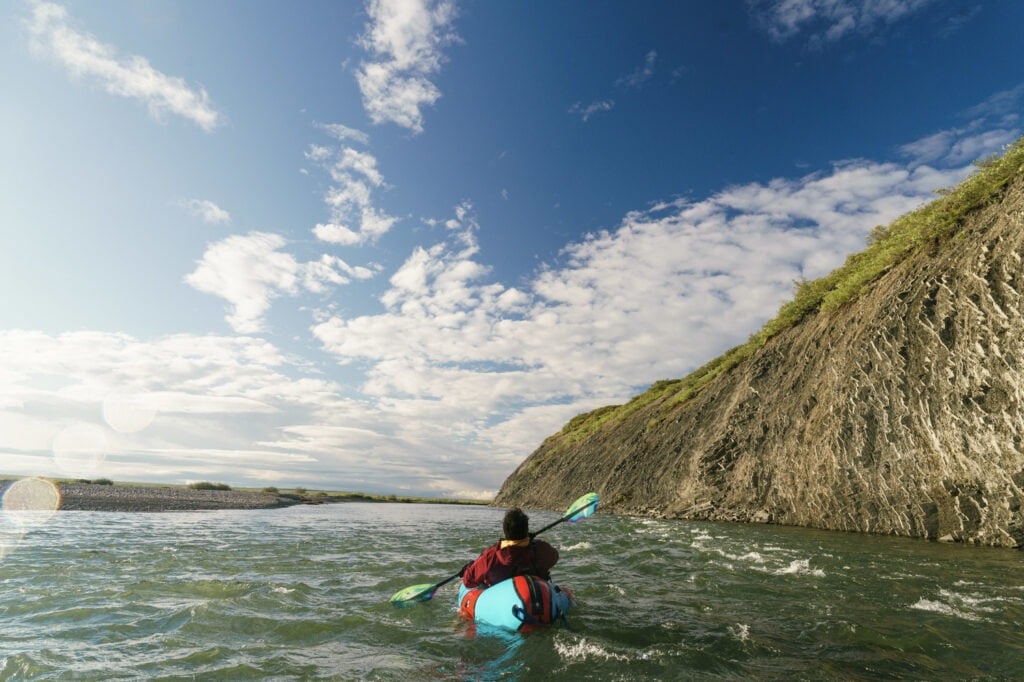
We floated past thick willow stands where a grizzly, startled by our approach, sprang up from its nap and bolted for the hills. Just minutes later, we rounded a bend and saw a wolf standing in a small clearing in the willows, lowering its head to drink from the river. It froze when it saw us, eyes locked with ours across the current, and waited silently, tense but unmoving, until we drifted past; then it turned and vanished into the willows. The river curved gently through a wide plain, its gravel bars scattered with ancient caribou antlers and glacial erratics worn smooth by centuries of melt and flood. Ponds dotted the tundra like mirrors tipped to the sky. In the distance, the Brooks Range stretched across the southern horizon, its ridgelines catching the last light of a sun that refused to set, only circling lower and lower toward the edge of the world. That evening, as we floated through the blue hours of Arctic twilight, the landscape glowed in a palette of subdued golds and bruised purples. The air felt still, but not silent. The river murmured softly against its banks, and the mosquitoes kept up their endless orbit.
Somewhere in that stillness, the weight of the place settled in. I couldn’t stop thinking about how this exact landscape, one so very alive, intact, and teeming with story, was categorized as a Petroleum Reserve. Just east of here, the Arctic National Wildlife Refuge has a name that protects it, or at least slows its undoing. Here, in the National Petroleum Reserve–Alaska, the same ecosystem carries a different legal and cultural weight. The difference is not in the soil, or the caribou, or the rivers, but in what we’ve called it, and what we’ve decided it’s for. It was in that moment, surrounded by stillness and light, that the idea of a “sacrifice zone” no longer felt rhetorical. It felt immediate.
For communities on Alaska’s North Slope, oil development is both a promise and a risk. The Iñupiat have used oil revenues to build schools, clinics, and infrastructure. At the same time, they’ve borne the brunt of industrialization from pollution, to landscape fragmentation, and increasing vulnerability to boom-and-bust economic cycles. Some Iñupiat leaders support projects like Willow, seeing them as critical to self-determination. Others warn that the long-term impacts on hunting grounds, subsistence food systems, and cultural continuity may be irreversible. Further south, the Gwich’in have voiced unequivocal opposition. Their way of life is tied to the Porcupine Caribou Herd, which calves in the Arctic Refuge but ranges widely. Any disruption to that migration risks severing ties that are ecological, spiritual, and generational.
These are not simple binaries. The debate over the future of the NPR-A is not just a question of yes or no to oil. It is a debate about sovereignty, about who controls the terms of development, and about what is owed to the people who have lived with this land long before it was renamed for petroleum. It is also a debate about climate change, about the contradiction of investing billions in fossil fuel infrastructure in one of the fastest-warming places on Earth. The Arctic is warming four times faster than the global average. Thawing ground damages pipelines, erodes roads, and compromises drilling pads. Yet those same thawed areas make extraction cheaper and more accessible, inviting more risk.
This paradox, of collapse creating opportunity, is not unique to the Arctic. It echoes across the country. In the Southwest, where I grew up, uranium mining devastated the Navajo Nation under the pretense of national defense. My grandfather worked in those mines. That job paid for my education, but it also left behind poisoned aquifers and a public health crisis that spans generations. At Oak Flat in Arizona, sacred Apache land is being turned over to a multinational mining company to extract copper deemed “critical” to U.S. energy and military interests. Along the U.S.-Mexico border, Organ Pipe Cactus National Monument was partially dynamited to make way for a wall, with Indigenous burial sites reduced to rubble in the name of security. These places share a designation not in law, but in logic. They are sacrifice zones, spaces where destruction is justified because it has been decided the nation needs what lies beneath.
The Arctic is the latest chapter in a long story of sacrifice zones, places deemed necessary to give up for someone else’s version of progress. But it doesn’t have to follow the same script. As we moved downstream, the Colville began to braid wide across the landscape. Its banks were sharp and unstable, shaped by seasonal thaw and the steady rearrangement of river and tundra. I kept returning to a simple truth: the difference between a refuge and a reserve isn’t ecological, it’s political. Caribou don’t recognize protected boundaries. Rivers don’t behave differently because they flow through a park instead of a lease area. The land doesn’t change because of what we name it. What changes is how we treat it.
Our route traced an ancient trade corridor, one that predates borders, property lines, or federal designations. For generations, people moved through this region, carrying stories, tools, and knowledge linking the Arctic to the Pacific. We came here by packraft, not to trade goods, but to follow that route and document a landscape on the edge of irreversible change. And even as we carried cameras instead of caribou hides, I couldn’t help but think about what we were taking. We were visitors, taking an experience, taking a story. That, too, is a kind of extraction, subtle though it may be. But in telling this story, our aim was to give something back: to draw attention to a landscape often left out of the public imagination, tucked in the corner of Alaska, rarely spoken of in debates over public lands and climate policy, but no less vital.
What we encountered wasn’t wilderness in the romantic sense. It was a living, dynamic place shaped by deep human memory, and increasingly pressured by systems far beyond its reach. The fragility here is not because the landscape is weak. It’s because decisions made elsewhere have made it vulnerable. Policy, warming, national security, they all converge here, quietly, persistently, and the effects are written into the banks of the river and the patterns of the permafrost.
The future of this place is already being negotiated. The question is not whether the Arctic will change, but how and who will get to decide what that change looks like. Will this region continue to be managed as a reservoir of oil, or can it become a model for something else?
The Nigu River didn’t give us answers. But it altered the questions I carry. And sometimes, in a place like this, that’s enough.


This Advocacy & Alliance Adventure Grant Project was Supported by Brand Alliance partner:


Author: Len Necefer
Dr. Len Necefer, Ph.D., is the CEO & Founder of NativesOutdoors – a native-owned athletic and creative collective. He holds a Bachelor’s in Mechanical Engineering and a Doctorate in Engineering and Public Policy from Carnegie Mellon University. Previous to this role, Len has worked for the U.S. Department of Energy and, most recently, the University […]
