
Funding Uncertainty Threatens to Sink Critical Ocean Research
Thousands of data-gathering robots floating in the ocean help us forecast climate and weather impacts, but funding is running out.
Today, the sea surface temperature near Palmyra Atoll – a tiny stroke of land in the middle of the Pacific, thousands of miles from the nearest ski resort – is about a degree warmer than usual.
That one degree is small enough to miss from a boat deck, but important enough to help reroute the jet stream. It’s a leading signal for where snow will, and won’t, fall in your local mountains this winter. Why? Warm water heats the air above it, which lowers surface pressure over that stretch of ocean.
Normally, the trade winds blow east to west across the Pacific, holding warm water pinned near Indonesia and keeping places like Palmyra comparatively cool. But when these winds weaken, it triggers a feedback loop: a warm patch appears, the pressure balance shifts, the trade winds weaken further, and more warm water slides east, reinforcing this process. That pool of warm water changes where storms fire up over the open Pacific and shifts the jet stream, which eventually reshapes the storm track barreling into the Rockies months later.
So how do we know the water at Palmyra is a degree warmer today? Nobody’s out there with a thermometer. We know because of a global fleet of around 4,000 autonomous robotic floats that have been profiling ocean temperature in real time since the early 2000s. These floats are collecting critical scientific data from over a mile deep underwater, then rising to the surface every 10 days to beam that data via satellite for the world to use. The program is called Argo, and it’s currently under threat of defunding due to the actions of the Trump Administration.
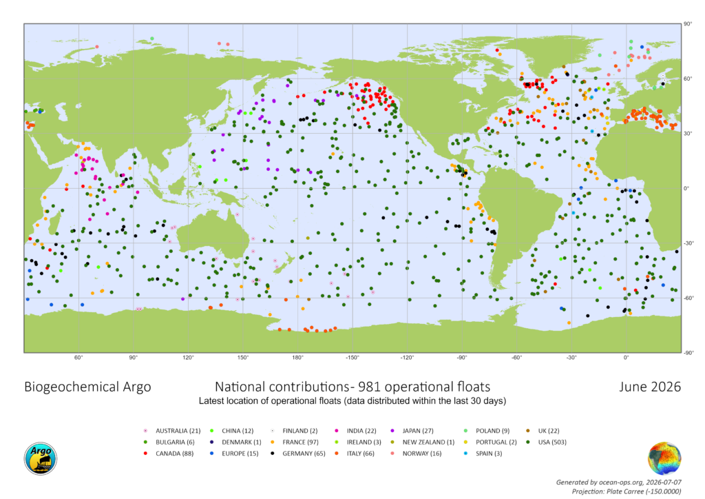
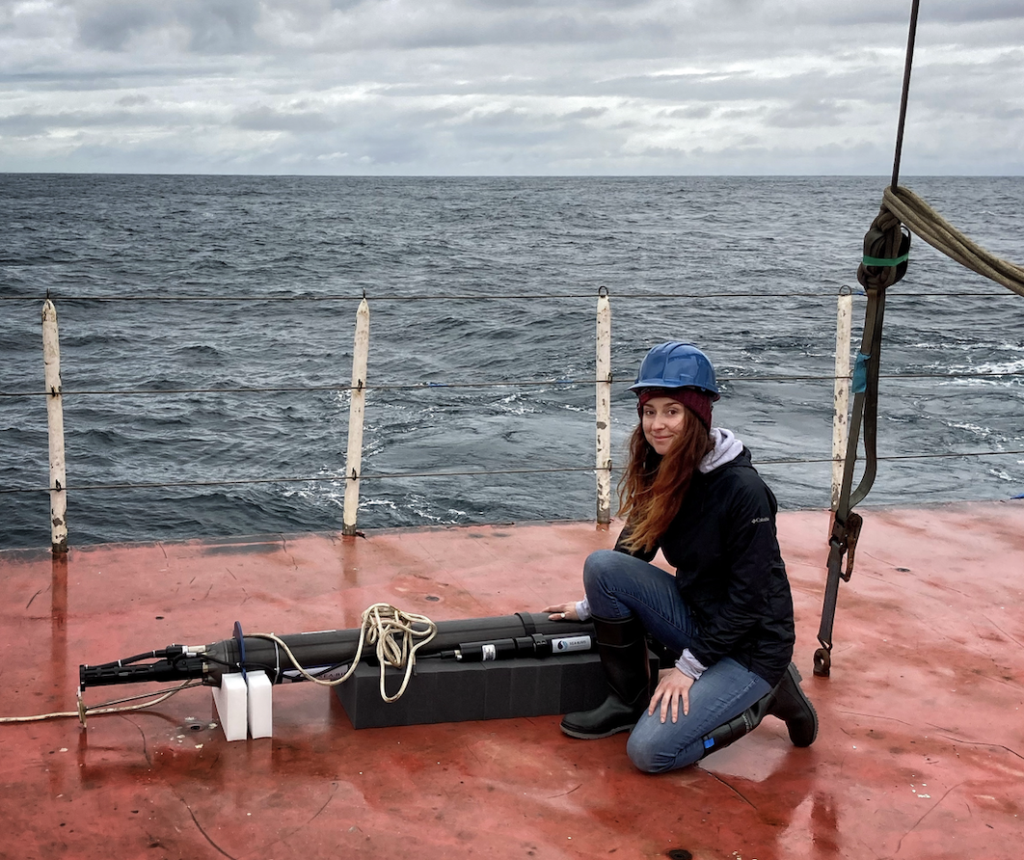
Argo floats collect up-to-the-minute data on ocean temperature, salinity, and pressure, which is used by weather forecasters, fisheries, mariners, scientists, the military, and more. In recent years, more advanced Argo floats have been developed. This includes Biogeochemical (BGC) Argo, which are equipped with biogeochemical sensors that test oxygen, pH, nitrate, and chlorophyll, and deep Argo, which can travel to depths of up to nearly 4 miles to discover deep ocean processes.
All of this helps scientists understand how the ocean functions and how climate change is impacting our ocean ecosystems and coastal areas. Data from Argo is used in over 500 scientific publications each year, and literally every weather forecast you’ve ever relied on before heading outside starts with this ocean data.
“The ocean stores the bulk of heat and moisture that drives our weather,” says Dr. Shawnee Traylor, a chemical oceanographer and carbon cycle scientist who’s part of the POW Science Alliance. “Satellites capture the surface, but forecasters need that subsurface picture to understand what’s brewing below and when we’ll see it in the weather.”
The ocean absorbs some 30 percent of all human-made CO2 emissions. This heating causes the water to expand and drives sea level rise, accounting for about a third of the increase. Argo data also helps us understand the rate at which thermal expansion is happening and how warming changes currents, which can be a critical warning for coastal communities.
Argo, named after a mythical Greek ship, was first introduced in 1999, and over the last two decades, it has revolutionized what we know about the ocean. One groundbreaking study showed how much excess heat the ocean is absorbing due to global warming. “It’s like exploding 12 atomic bombs in the ocean each second,” Traylor says. “We only know those numbers because of Argo.” Traylor studies how the ocean absorbs and stores carbon, so Argo is a critical part of her research.
Before Argo, studying the ocean was done mostly from ships. “That is many orders of magnitude more expensive and time intensive,” Traylor says. “Now we have a daily snapshot of the ocean at very little cost. The data is then made freely available to the public within a day.” Each profile from an Argo float costs around $200.
The U.S. has deployed and maintained over half of Argo’s global fleet. Funding is decentralized and has come from a variety of sources, including the National Oceanic and Atmospheric Administration (NOAA) and the National Science Foundation (NSF). A five-year NSF grant that funded the launch of 500 new BGC-Argo floats has expired, and the proposal for a new grant to maintain the fleet is currently in limbo. Over 20 months have passed since the program’s leaders applied for funding with NSF, and they’ve received no response; typically, they hear back within six months.
We haven’t been told no yet, but we’re running out of time. At a certain point, we start losing jobs and decades of critical technical expertise,” Traylor says. “Right now, our future funding is uncertain.”
The Trump Administration has severely cut scientific funding across the board, specifically climate research, and grants for oceanography have been slashed in half since last year. For BGC Argo, there isn’t any money left to build U.S. floats in the next year. “Data quality will start degrading, and within a couple of years, that’ll show up downstream as less reliable forecasts for extreme weather events,” Traylor says.
Ocean data helps us predict snowpack models and prepare for extreme weather events like hurricanes. “Even if they’ve never seen it, everyone is deeply tied to the ocean,” Traylor says. “Sparser data means less warning, particularly about how intense a storm might get. People who care about winter’s disappearance should also care about the ocean data that can tell us how quickly that’s coming.”
So, what can we do to ensure ocean research continues in the future? Congressional support for Argo could make a big impact. Recent attempts to dismantle and defund another ocean research program, called Ocean Observatories Initiative, or OOI, were blocked by bipartisan support from Congress. In June, U.S. Senators Jeff Merkley, a Democrat from Oregon, and Lisa Murkowski, a Republican from Alaska, passed legislation that successfully stopped the dismantling of OOI.
“The OOI system delivers crucial information about our ocean patterns and weather, reaching and touching all Americans,” stated a letter to NSF signed by 11 U.S. Senators. “The effort to dismantle this vital network, jeopardizing decades of prior research, must be reversed in order to prioritize public safety.”
Argo needs a similar win. “Public pressure on governments might help,” Traylor says. “But right now, we need to raise awareness. Even in marine science, many don’t know about the looming threat to one of the most successful research programs in the world.”

Author: Megan Michelson
Megan Michelson is a freelance journalist based in Tahoe City, California. She is a contributing editor at Outside Magazine, an editor at large at Backcountry Magazine, and a contributor to publications like the New York Times, the San Francisco Chronicle, Ski Magazine, Powder Magazine, and more.
